LiDAR technology advantages help shape the future
The application of LiDAR, which stands for "Light Detection and Ranging," varies from self-driving cars and robotics to environmental monitoring to urban planning and archaeology. Its ability to generate accurate, high-resolution 3D maps of physical environments has made it an essential tool in many fields, where it is used to improve safety, increase efficiency, and enable new applications.
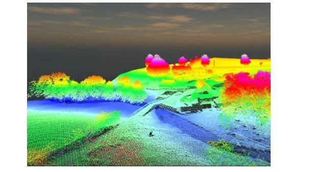
LiDAR has many applications and benefits across industries.
Advantages
LiDAR sensors have been around since the 1960s, but it was not until 20 years later, when GPS appeared, they were used more widely in the fields of life and science. LiDAR sensor has many advantages such as:
High-precision distance measurement
LiDAR sensor technology is capable of measuring distances with high accuracy. Using LiDAR to measure the distance from the Earth to the Moon has an error of only a few millimeters.
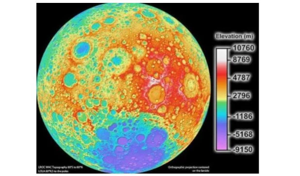
Apollo 15 spacecraft crews had used LIDAR technology to map the Moon's surface since 1971.
High-resolution image reproduction
The image reproduced by LiDAR technology has enough detail to not only show objects, but also reveal their shape, texture and orientation. That's why survey planes apply this technology to map the surfaces and features beneath trees and vegetation.
Dynamic 3D image reconstruction
A LiDAR scanner can also reproduce 3D images with the timescale. A typical example is that scientists often use LiDAR sensors in agriculture to locate swarms of flying insects by species and minimize their impact.
Applications
Automotive and Mobility
LiDAR has become a vital tool for developing self-driving cars. By using LiDAR, engineers can create detailed maps of roads and traffic patterns, allowing autonomous vehicles to navigate more safely and effectively.
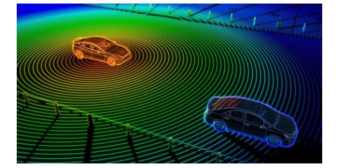
LiDar has been widely applied to innovate autonomous vehicles.
Archaeology
In archaeology, LiDAR technology has been used to uncover previously unknown ruins and settlements. By scanning an area from the air, researchers can create a detailed map of the landscape, which can reveal structures and features previously hidden from view. This has led to some remarkable discoveries, such as the ancient Mayan city of Tikal in Guatemala.
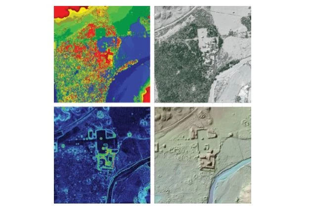
Four LiDAR data products from the Maya site of Copán in Honduras.
Agriculture
In agriculture, LiDAR is applied extensively to create detailed maps of fields, allowing farmers to optimize their crop yields. By precisely measuring soil moisture levels, crop health and other factors, LiDAR can help farmers identify areas that require more or less irrigation or fertilization, leading to more efficient use of resources.
Construction
In the construction industry, LiDAR has been an accurate and efficient assistant for creating building plans. By scanning a construction site, engineers can create 3D models of the space, allowing them to identify potential issues and create more precise plans. This can lead to faster construction times and reduced costs.
As LiDAR technology further evolves, its applications are only likely to increase, and it will undoubtedly play a significant role in shaping the future of many industries.
Should you have any questions or request a quotation of Rang Dong products, please send us an email to: export@rangdong.com.vn.
Websites: en.rangdong.com.vn and vacuumflask.rangdong.com.vn.


